
The Azores Profile
The Azores is an archipelago composed of nine volcanic islands in the Macaronesia region of the North Atlantic Ocean.
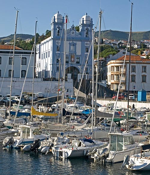
Marina of Angra do Heroísmo
The Azores is an archipelago composed of nine volcanic islands in the Macaronesia region of the North Atlantic Ocean. There are nine major Azorean islands and an islet cluster, in three main groups. These are Flores and Corvo to the west; Graciosa, Terceira, São Jorge, Pico, and Faial in the centre; and São Miguel, Santa Maria, and the Formigas islets to the east. They extend for more than 600 km (370 mi) and lie in a northwest–southeast direction. All the islands have volcanic origins, although some, such as Santa Maria, have had no recorded activity in the time since the islands were settled several centuries ago. Mount Pico on the island of Pico is the highest point in Portugal, at 2,351 m (7,713 ft). If measured from their base at the bottom of the ocean to their peaks, the Azores are among the tallest mountains on the planet. The Azores are located at the seismically active Azores triple junction plate boundary where the North American plate, Eurasian plate and Nubian plate meet.
The climate is very mild for such a northerly location, being influenced by its distance from the continents and by the passing Gulf Stream. Because of the marine influence, temperatures remain mild year-round. Daytime temperatures normally fluctuate between 16 and 25 °C (61 and 77 °F) depending on season.[10][11] Temperatures above 30 °C (86 °F) or below 3 °C (37 °F) are unknown in the major population centres. It is also generally wet and cloudy.
Its main industries are agriculture, dairy farming, livestock, fishing, and tourism, which has become a major service activity in the region. In the 20th century and to some extent into the 21st, the Azores have served as a waypoint for refueling aircraft flying between Europe and North America. The government of the Azores employs a large percentage of the population directly or indirectly in the service and tertiary sectors. The largest city is Ponta Delgada. The culture, dialect, cuisine, and traditions of the islands vary considerably, because these remote islands were settled sporadically over a span of two centuries.
AI Overview
The Azores, an autonomous region of Portugal located in the North Atlantic, is a volcanic archipelago renowned for its dramatic landscapes,, crater lakes, and rich marine life. As a key EU outpost with a population of around 236,000, it is a premier destination for sustainable tourism and, as of late 2024, features one of Europe’s largest marine protected areas.
Key Aspects of the Azores
Geography: Comprises nine volcanic islands divided into three groups (Eastern, Central, Western), featuring dramatic volcanic scenery and laurisilva forests.
Status: An Autonomous Region of Portugal and an outermost region of the European Union, situated in the Atlantic Ocean.
Capital Cities: Power is shared between Ponta Delgada (executive), Angra do Heroísmo (judicial), and Horta (legislative).
Economy & Environment: Known for agriculture, dairy, and tourism, the region is highly focused on sustainability, having recently protected 30% of its surrounding waters.
Tourism & Climate: Ranked among the best places to visit in 2025, offering whale watching, hiking, and scuba diving. The climate is mild and maritime, heavily influenced by the Gulf Stream.
Regional Significance
The Azores holds a strategic location in the North Atlantic and acts as a hub for maritime research, strengthening ties with areas like Bermuda regarding ocean management. The islands offer a distinct,, slower pace of life compared to mainland Europe, making them attractive for expats and travelers seeking natural,, untouched environments.
Azores
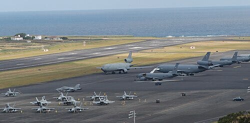
Lajes Air Base, on Terceira Island, is a joint Portuguese Air Force and United States Air Force military base
Article Talk
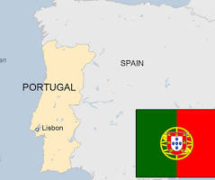
The Azores, officially the Autonomous Region of the Azores, is an autonomous region of Portugal, in the Atlantic Ocean about 1,400 km (870 miles) west of mainland Portugal. Together with Madeira, it is one of the two autonomous regions of Portugal and a special territory of the European Union. It is the westernmost point and region of Portugal
Azores
Açores (Portuguese)
Autonomous Region of Portugal and outermost region of the European Union
Autonomous Region of the Azores
Região Autónoma dos Açores (Portuguese)
Blue and white bands, superimposed by golden goshawk and surmounted by nine stars with traditional Portuguese shield in the left corner.
Flag Official seal of Azores
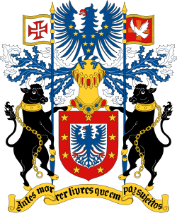
Coat of arms
Motto: Antes morrer livres que em paz sujeito
(English: “Sooner die free than subjected in peace”)
Anthem: Hino dos Açores
(English: “Hymn of the Azores”)
Location of the Azores within the European Union
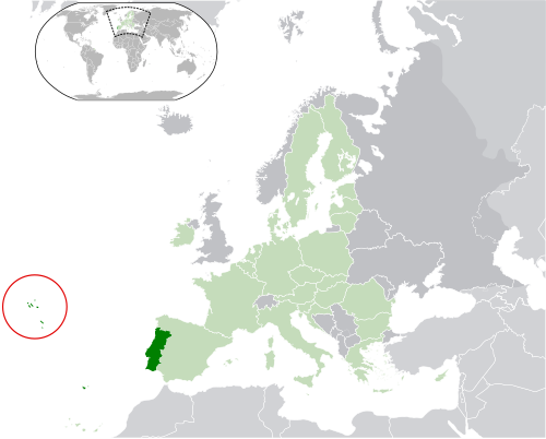
Location of the Azores within Portugal (dark green) and the European Union (light green)
Country
Portugal
Settlement
1432
Autonomous status
30 April 1976
Named for
Açor (English: Northern goshawk)
Capitals
Ponta Delgada (executive)
Angra do Heroísmo (judicial)
Horta (legislative)
38.66°N 28.07°W
Largest city
Ponta Delgada
Official languages
Portuguese
Demonym(s)
Azorean[a]
Government
Autonomous Region
• Representative of the Republic
Pedro Manuel dos Reis Alves Catarino
• Speaker
Luís Garcia
• President
José Manuel Bolieiro
• Vice President
Artur Lima
Legislature
Legislative Assembly
National and European representation
• Assembly of the Republic
5 MPs (of 230)
• European Parliament
3 MEP (of 21 Portuguese seats)
Area
• Total
2,351 km2 (908 sq mi)
Highest elevation (Mount Pico)
2,351 m (7,713 ft)
Lowest elevation (Atlantic Ocean)
0 m (0 ft)
Population
• 2021 census
236,440
• Density
110/km2 (284.9/sq mi)
GDP (nominal)
2024 estimate
• Total
Increase €5.753 billion
• Per capita
Increase €23,836
Source: Wikipedia
This is a nice snapshot of our beloved Archipelago